
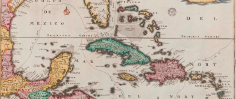
31 Mar Crowd helps unlocking historical maps of the Caribbean
Leiden University Libraries (UBL) has started the project Maps in the Crowd. Nearly 1,100 digitized maps of the Caribbean will be unlocked with help from visitors, students and others who are interested. The project started on the 20th of March and will continue until May 2017. With participation of the public we hope to improve the accessibility of digital map data for teaching and research.
Participation
A special application has been developed to help the participants connect the digitalized historical maps, through the process of georeferencing, to a modern topographical map in Google Maps. It is quite straightforward: the historical map and its modern counterpart can be connected by designating five or more corresponding control points. The georeferenced map will then be shown as an overlay in Google Maps. Everyone who is interested is welcome to join our project. More information is available on the blog Maps in the Crowd.
The Caribbean Maps
The collection of Caribbean maps consist of printed and hand-drawn maps (some of them in more sheets) and some atlases from the sixteenth to twentieth century of Central America and the Caribbean in general and the Netherlands Antilles in particular. The larger part of this collection is part of the bequest of the nineteenth century map collector Johannes Tiberius Bodel Nijenhuis (1797-1872), complemented with maps from the collections of the Royal Institute for Southeast-Asian and Caribbean Studies (KITLV) and the Royal Tropical Institute (KIT).
Note
Information, images and interviews:
Erik Weber, communications advisor University Libraries Leiden, [email protected] and 071 527 15 85 (Wednesday not available).
No Comments